GSS
SURVEY INSTRUMENTATION

Total Stations
General Surveying Services is well-equipped with the latest electronic Total Stations (including all necessary survey accessory items; tripods, tribraches, targets, prisms, etc.)., specially designed for measuring of slant distances, horizontal and vertical angles and elevations in topographic and geodetic works, tachometric surveys, as well as for solution of application geodetic tasks.

Precision & Spirit Levels
GSS also owns several auto and digital levels instruments. This type of level reduces the chance of human error when interpreting graduation marks, and a digital display ensures accurate readings. When job sites need fast and accurate height determinations, precision digital leveling equipment serves as valuable time-saving technology.

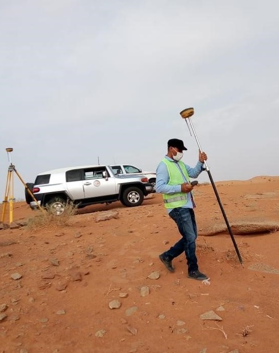
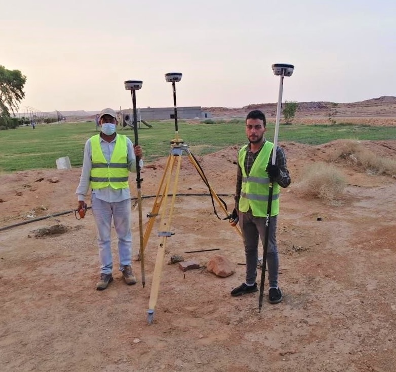
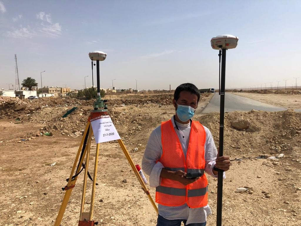
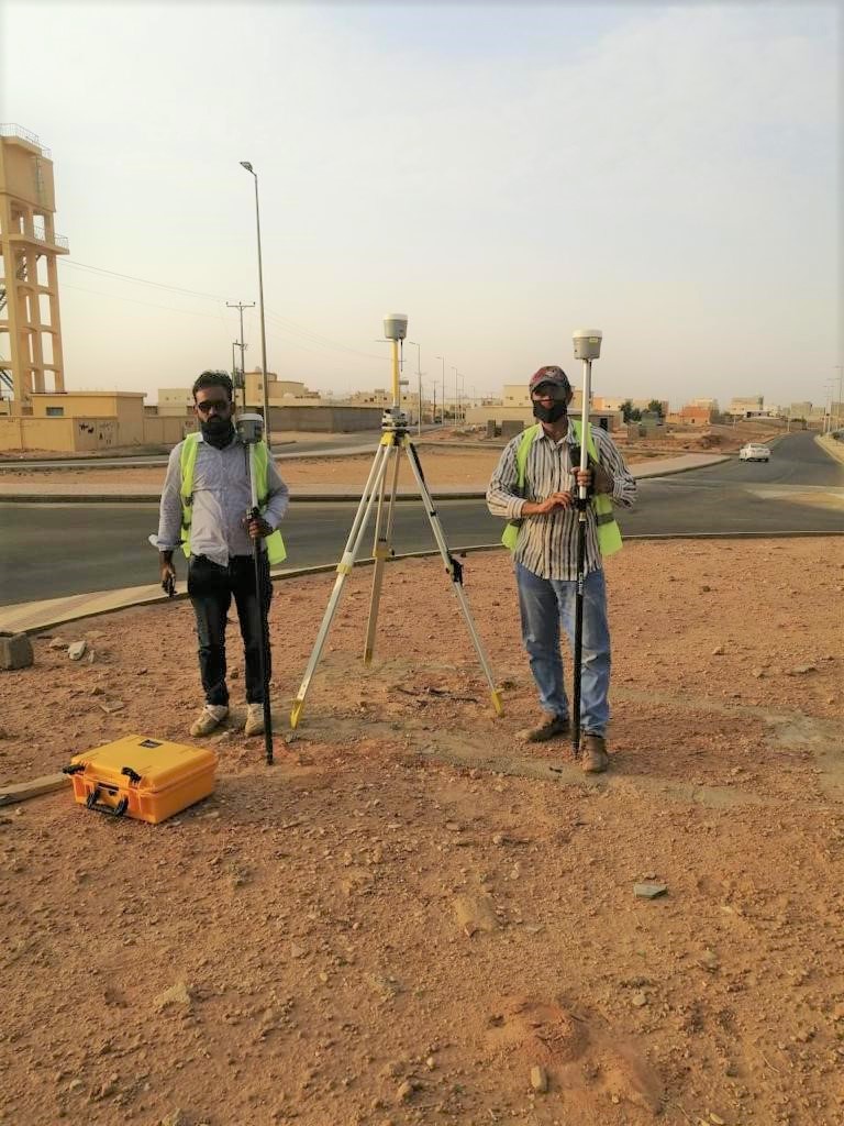
GPS (Global Positioning System)

When flexibility is needed in terms of satellite networks, ruggedness of hardware, great precision and right accessories for the job, GSS is providing the range, the power and low latency that ensures success with the most exacting standards of data quality. Equipment is carefully selected to match and surpass high expectations of a busy professional.
MAIN SERVICES
A topographical land survey that shows the height, depth, size and location of any manmade or natural features on a given parcel of land, as well as the changes or contours in elevation throughout the parcel.
A surveying that specializes in the establishment and re-establishment of real property boundaries. It is an important component of the legal creation of properties. A cadastral surveyor must apply both the spatial-measurement principles of general surveying and legal principles such as respect of neighboring titles.
An as-built survey of existing conditions of the future work site, including topography, existing buildings and infrastructure, and underground infrastructure whenever possible (for example, measuring invert elevations and diameters of sewers at manholes). Also used for stake out reference points and markers that will guide the construction of new structures, and verifying the location of structures during construction.
A survey that ensures the permission required for planning in order to be allowed to build on land, or change.
Also called survey monuments, survey benchmarks or geodetic marks, a survey that offers the solutions to place a mark key survey point on the Earth’s surface, using different topographical methods.
The Process
We remain true to the same principles on which our company was founded over a hundred years ago: providing superior service to our clients, putting safety first, creating opportunities for our people, delivering exceptional work, fostering innovation, acting with integrity, and strengthening our communities.
Construction is the process of constructing a building or infrastructure. Construction differs from manufacturing in that manufacturing typically involves mass production of similar items without a designated purchaser.
Our price list
Basic
- 500+ Sq Metres
- Up to 10 Rooms
- Swimming Pool Included
- Premium Materials
- Floor Plan Design
- 24/7 Customer Support
Business
- 500+ Sq Metres
- Up to 10 Rooms
- Swimming Pool Included
- Premium Materials
- Floor Plan Design
- 24/7 Customer Support
Premium
- 500+ Sq Metres
- Up to 10 Rooms
- Swimming Pool Included
- Premium Materials
- Floor Plan Design
- 24/7 Customer Support