3D Laser Scan to BIM Solutions
General Surveying Services provides a variety of professional applications for both the private and public sector with unique tailored solutions for our clients.


FLATNESS AND LEVELNESS CHECKING
Quality Assurance (QA) and Quality Control (QC) management tools to perform accurate full measurements continuously throughout the build process and immediately find discrepancies. Additionally, such early detection enables architects and contractors to produce higher quality projects while saving time and money since errors are minimized and rework cost is subsequently reduced.


CONSTRUCTIION PROGRESS MONITORTIING
Seamless capture and monitoring of construction progress for legal and technical documentation;
BUILD ENVIRONMENT
Precise geometrical recording of existing properties as the basis for conversions or extensions;

QUALITY CONTROL & INSPECTIONS
Precise laser scanning survey ensures that the final as-built condition fit design intent and minimizes the chance of potential problems;
EXCAVATION CONTROL
Precise volume and dimension control of excavations and stockpiles volume;
Our price list
Basic
- 500+ Sq Metres
- Up to 10 Rooms
- Swimming Pool Included
- Premium Materials
- Floor Plan Design
- 24/7 Customer Support
Business
- 500+ Sq Metres
- Up to 10 Rooms
- Swimming Pool Included
- Premium Materials
- Floor Plan Design
- 24/7 Customer Support
Premium
- 500+ Sq Metres
- Up to 10 Rooms
- Swimming Pool Included
- Premium Materials
- Floor Plan Design
- 24/7 Customer Support
Facade Inspections
dimensional inspection in 3D of building shells and facade components before final assembly or any change.


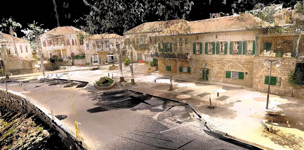
Heritage
Archeological site works
Deformation Control
Documentation of deformation processes and monitoring of countermeasures as well as verticality checking;

Dilapidations Surveys
Precise 3D documentation of the current state of the property;
Structural Analysis and Maintenance
Control of beams deflections and deviations, slabs, ceilings, columns, walls, etc.;

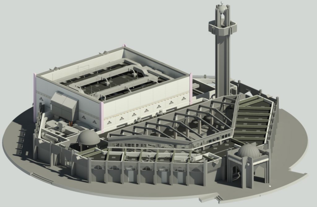
MEP Survey Services
MEP documentation, as-built survey and 3D modeling;
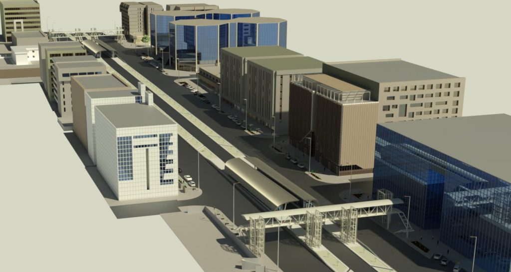
Renderings
High-end 3D rendered models using specialized software.


Data Analysis
Contour maps, elevation maps, deflection, deviation & alignment analysis and detailing;
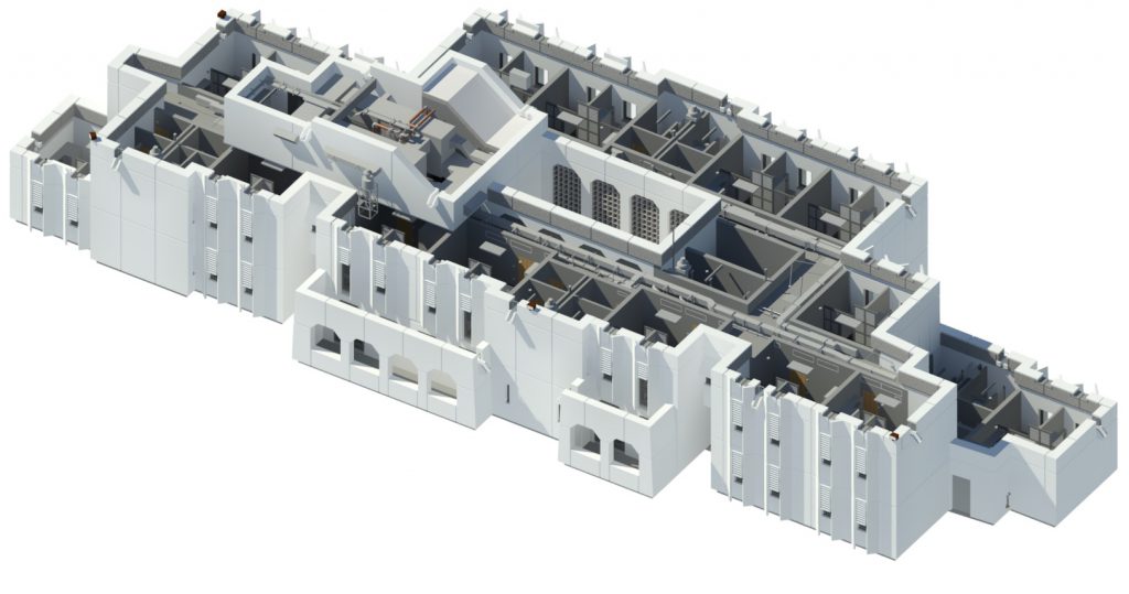
As-Built Survey & BIM Modeling
3D Model recreation & 3D Revit Renderings;
